The Geology of Painted Canyons
This information was produced by Natalie Tanski at Utah State University. Production was funded as part of the outreach component of a research project funded by the National Science Foundation Grant # 1824852 to Jim Evans, at Utah State University. Contact James.evans@usu.edu for more information.
On The Trail
Points of Interest: Includes trail directions and geology! Follow a clockwise loop by going up Ladder Canyon and down Painted Canyon
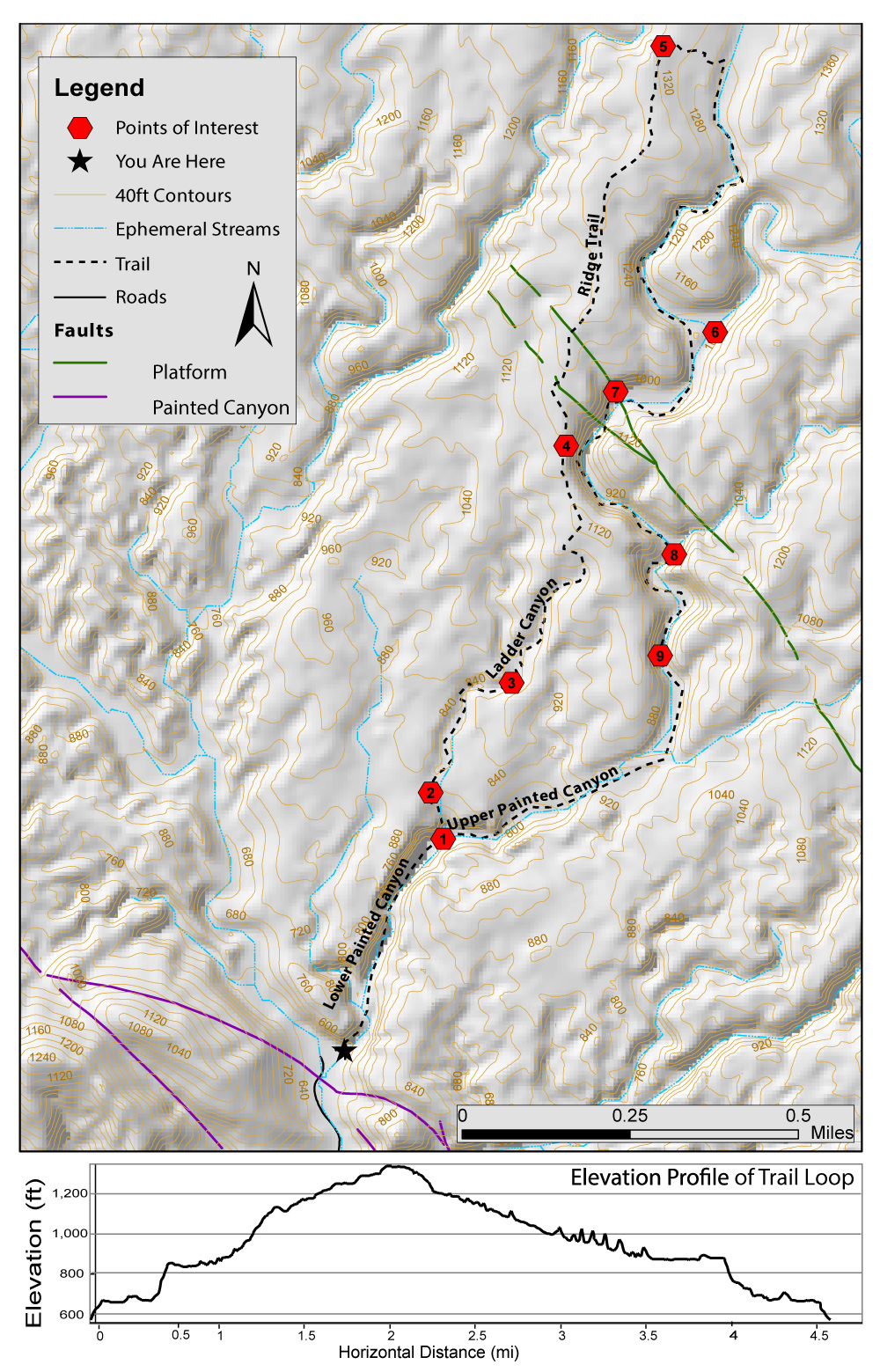
Point 1
Turn for Ladder Canyon is marked by a big cobble arrow on the stream bed pointing to a large rockfall.
Since the start of the trail and through Ladder Canyon, you are in the Upper Palm Spring Formation, once an alluvial fan.
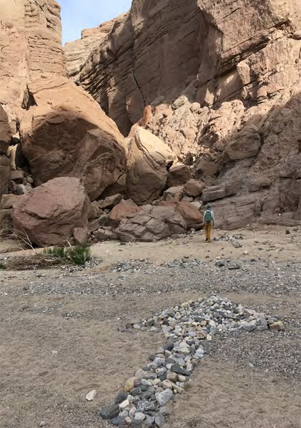
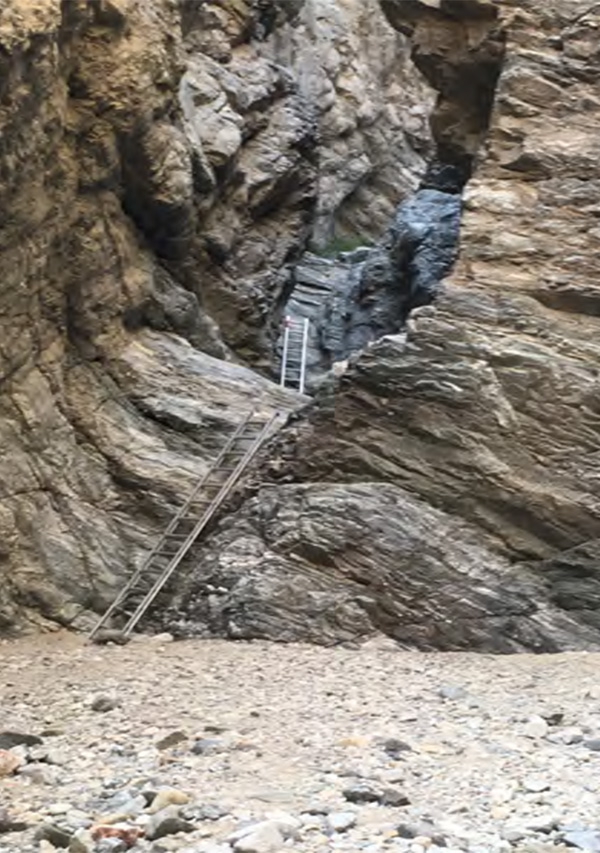
Point 2
In Ladder Canyon there are a total of 5 ladders with the tall-est being ~12 ft high
This slot canyon is formed by the incision that happens during flash floods and heavy rain.
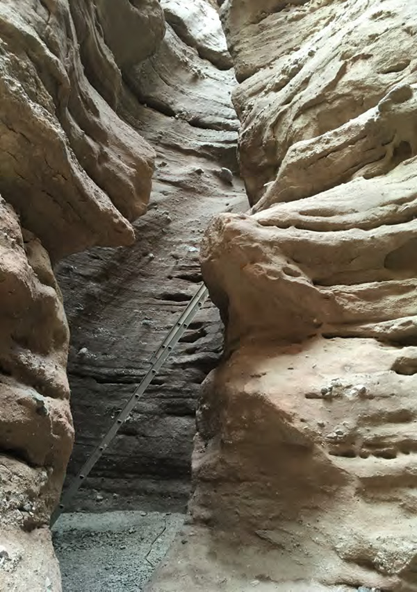
Point 3
Stay in the drianage at the trail split (you can follow the labeled “up?” trail to a view-point) and eventually you will come up on to this ridge. Once on the ridge follow the arrows and continue going north.
From the ridge you can see the Salton Sea towards the south and the Santa Rosa Mountains towards the west.
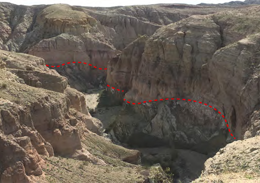
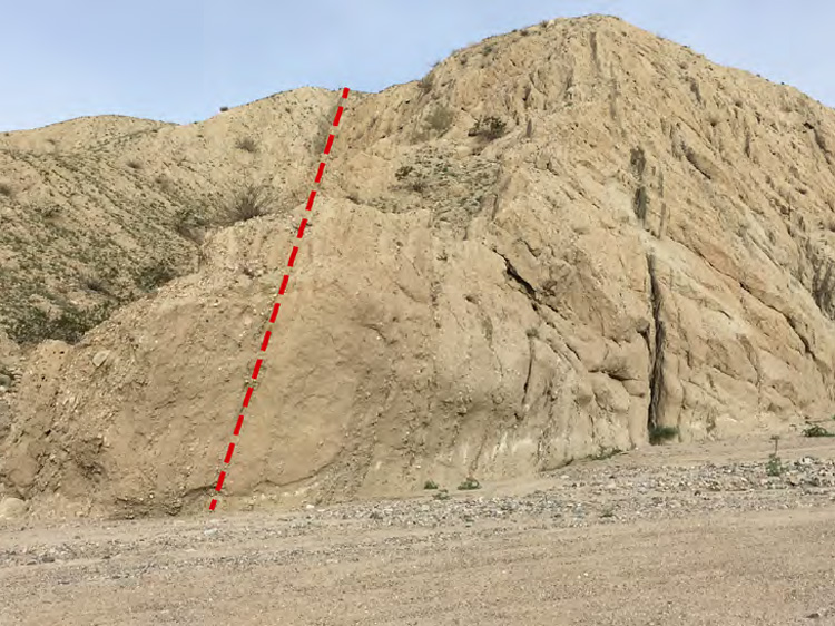
Point 4
Along the ridge you will find a view of a nonconformity down in Painted Canyon. Here you can see the basin fill sedimentary layers lying on crystalline base-ment rock marking the unconformity.
Point 5
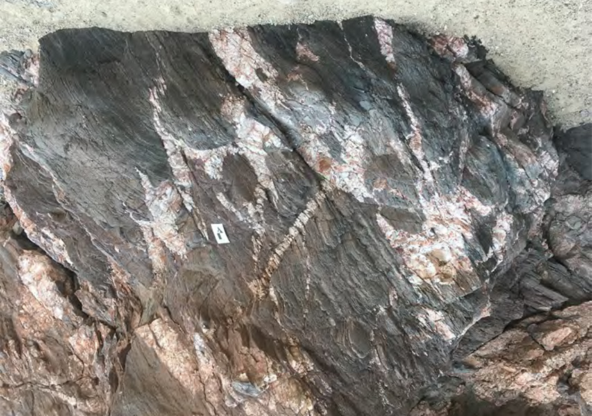
Take a right down the ridge into Upper Painted Canyon, as you enter the canyon you will notice that you’re in a new geologic layer, the Orocopia Schist - a metamorphosed rock.
Point 6
Fork in Painted Canyon, continue going south.
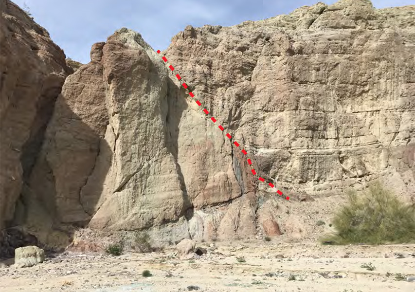
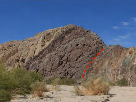
Point 7
On the west wall, you will see an exposure of the Platform Fault. The dots above on both sides of the fault symbolize the direction of movement as if you were looking at the front or back of an arrow.
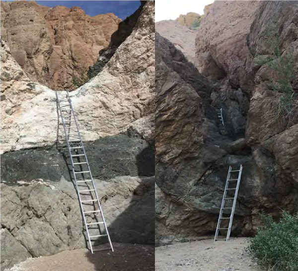
Point 8
Turn off for “Scary Ladder Canyon”, expect a total of 3 ladders that may not be bolted in.
Point 9
The last 2 ladders are short
On Your Way Out
Geologic Viewpoints Along Painted Canyon Road
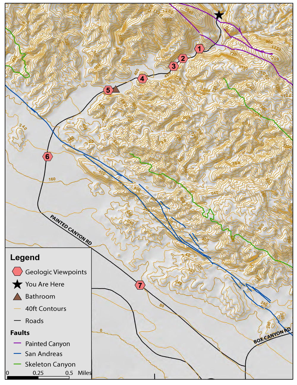
As you drive out along Painted Canyon Rd set your mileage to 0 at the trailhead/parking lot to follow our Geology Viewpoints - where the geology can be seen right through your car window!
Points 1 & 2
At 0.5 Miles the Cretaceous and Precambrian crystalline basement is seen. At 0.7 miles you now are in the Mecca Hills Formation, the redder sandstones, conglomerates, and siltstones. The red color is due to iron oxide produced from weathering. The contact between these two rock types is known as a nonconformity because these sedimentary rocks overlie eroded igneous and metamorphic rocks.
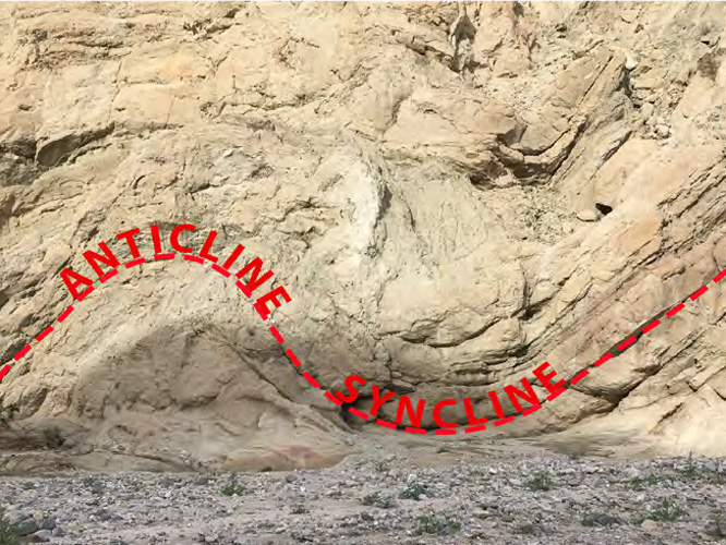
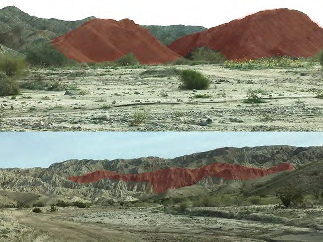
Point 3
At 0.9 miles, right before the wash opens up, on the west side, there is a dual fold in the rock, where the concave curve is called an anticline and the convex curve is called a syncline. These usually come in pairs as seen here. This type of structure is called ductile deformation since the rocks are folding and bending under stress instead of breaking into faults and fractures.
Points 4 & 5
At miles 1.3 to 1.6 on both sides of the road there are vertically dipping sandstones and pebbly sand-stones. This geologic layer was deposited on a relatively flat surface and has since been uplifted and turned due to the compression along the San Andreas Fault Zone in the Mecca Hills Area. These tan colored sandstones are part of the Palm Spring Formation.
Points 6 & 7
At miles 2.4 and 3.9 red hued mudstone appears in the hills. This mudstone has been sheared laterally/horizontally along the western side of the San Andreas. This mudstone came from the south but its origin is unknown.
Safety and Emergency Q & A
Q: What do I need to bring on my hike?
A: Your brain, water, snacks, supportable shoes
Q: When is the “big one” going to happen?
A: Seismic data tells us that the San Andreas is “overdue for an earthquake” due to its measured average rupturing. It is predicted that a 7.5 magni-tude or greater earthquake will effect the Southern San Andreas but it is very difficult to predict when this will happen. The last big SAF earthquake here was in 1726.
Q: What should I do if there is an earthquake?
A: If you are in any canyons, hug the walls or find an overhang to hide under. If you are on any ridges, stay away from the edge. Good luck.
Q: What should I do if there is a Flash Flood? How can I avoid one?
A: Immediately look for somewhere safe to scramble up to higher ground. Check the weather before you hike to avoid days of heavy precipitation.
For more information visit Roadside Geology of Southern California by Arthur Sylvester and Elizabeth O’Black Gans California Trails South Coast Region